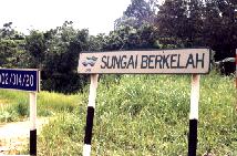
Enchanting Land- the Berkelah Waterfalls This Waterfall or waterfalls were admired by the many who had seen them. Very natural settings and beautifully carved out falls. As it is located in a sparsely populated locality, it is difficult to identify any landmark for those who have not being there to make entry to the waterfall area.
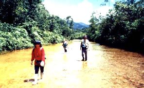
This is adventure land! River trekking, walking through 'desert', wondering where the river has disappeared to and behold! Waterfall after waterfall. The regular mode to reach the waterfall area, is to get transported overland by 4X4 vehicle through the mini-estates for 8 kilometers { as mentioned in the book on "Waterfalls"}. Alternately, which most people traveling on a budget do, is to follow the river beside the pump house. The river trekking and hiking trail is only 5 kilometers. Either method too, will meet up at one mid-point, then follow the same trail to the end. i.e. when the motorized tracks end. Just for the archives and for those of you who cannot find the way-in. First move, following the river upstream is an easy way and best bet.
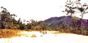
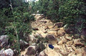
Then, after this stretch, it is nice broad track among low brushes for a while. Here after completing a third of the way strolling on the river bed, the group trekked through this desert-like basin terrain, there was some difficulty in seeing the track, but we stayed close to the river basin.
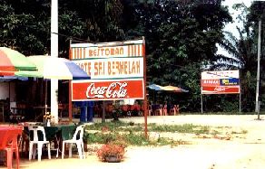
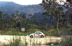
Now this first portion described here will be relevant to those reaching this place by public transport i.e. Bus You lucky guys with cars- it is good & bad news too! Surf On- Those coming from the river will also meet up at this same place, you walk - they drive!
Caution! In the last months, reports that this new road was not properly upkept, making difficult for cars to go through. At this point, after the arid landscape earlier on, the terrain changes into a type with low bushes and dry river bed.
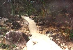
There is a sign to show the overall distance to the fall as 700 meters, but takes a good 30 minutes walk, cement path and laterite trail. Caution: There are rumors about this place being "uncleaned" Many reports of visitors getting lost. For us, there are reasons and over confident is the main one. Open country gives the impression that it is easier to spot distant landmarks. No- it is also make recognizing immediate tracking signs more confusing. 2 places are misleading, the dry river bed above and trekking by the river bank. Stay by the river side and don't try to venture out!
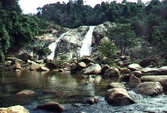
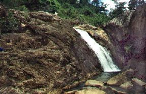
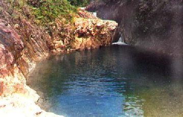
All the waterfalls here have one distinctive feature, they have pool at the base, ranging from fair size to large. Very deep and dark blue in color. Without land clearing [just starting] the water is perpetually clear. The stony geology with sharp drops forces the strong water power from floods to dig deep. The effects of the vertical forces from sudden down pour do not work on the edges to widen but deepens the pool area. This 1st waterfall above is preceded by 2 gorgeous looking 'baby' falls, some 25 meters above. Now we continue with more waterfalls and their appearances. If you think that the 1st waterfall is large and majestic, wait till you see those further up! The tallest falls being the 3rd and the last - 4th fall.
The journey up to this point can be budgeted as follows:
Profile of the river - moving from downstream upwards.
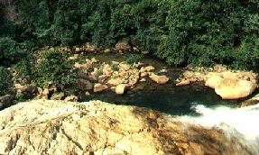
Most day trip visitors do not find time to move all the way up. Here is one scene taken from the top of the starting point
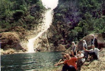
There are safe campsites along that few kilometers stretch of unspoilt natural wonderland. Safe from rising water in the night and on dry land away from the banks. We had the pleasure of meeting up with Miss Asmaliza Abdullah and the "Latepackers Inc.". They are members of IIUM Adventure and Recreational Club. To the lesser prepared trekkers, let me assure you that the hard walk is definately worth the efforts. The view of the water is superb and unique. A journey with the overnight stay at this destination - an ultimate venue for adventure. Again, the area is also acknowledged to be treacherous. We should ensure that it remains well-preserved, at least the area besides the river banks. KEEP THE PLACE CLEAN |